Ground Control
Take the ground and tower positions at twelve real airports and keep the traffic moving — without ever compromising runway safety.
- 12 real airports
- Real taxiways from OpenStreetMap
- Plays offline
- No ads, no data collected
// the job
Easy to read. Hard to master.
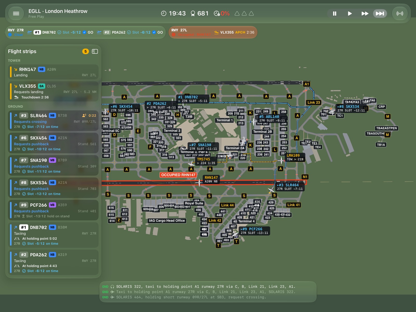
Every clearance is one tap away, and every aircraft tells you where it is going and when.
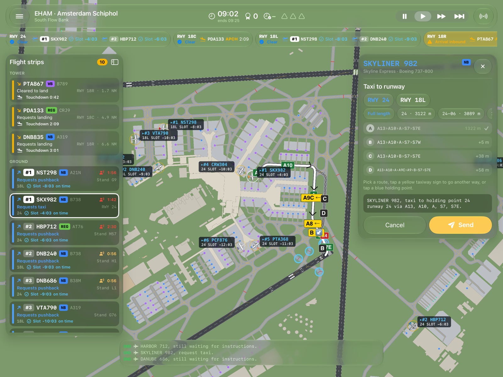
Taxi routes in one tap
Select an aircraft and its clearance is ready: a suggested route plus alternatives, drawn on the map. Tap a yellow sign to go another way.
Runway safety first
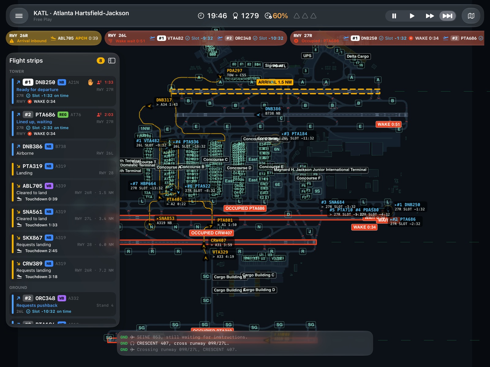
Landing, line-up and take-off clearances, crossings behind red stop bars, wake turbulence spacing, go-arounds and incursions.
Slots and punctuality
Every departure has a slot. Countdowns for touchdown, arrival on stand, end of turnaround and take-off keep you ahead.
Pushbacks and tows
Push aircraft back facing the way you choose, tow repositioning flights from remote stands to the gates, and tow back anyone stuck nose to nose.
Weather and nights
Rain, low visibility and thunderstorms; evening shifts fade into night with stop bars, centreline lights and maintenance closures.
Map or ground radar
A clean airport map or an ASDE-X-style ground radar, radio phraseology with optional voices, pause and 2× / 4× time.
// the airports
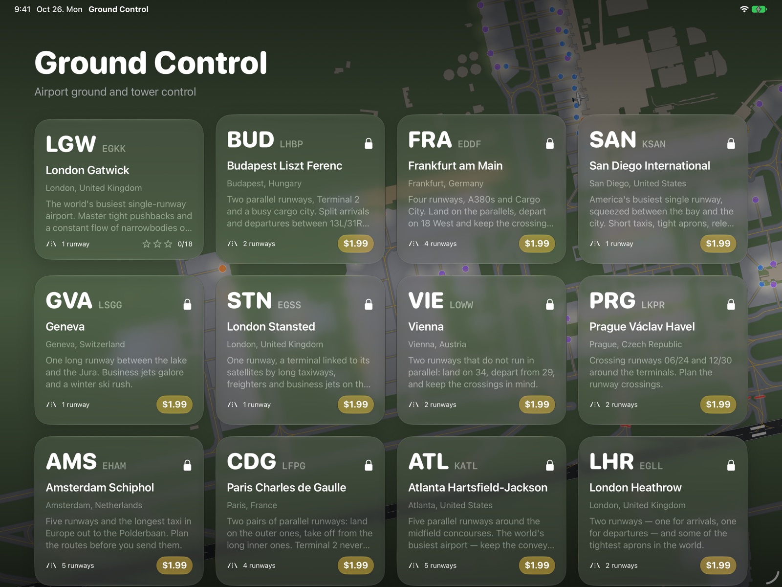
Twelve real airports
Layouts, taxiway names, holding points and stands from OpenStreetMap — each in a compact simplified version and the full-size airport.
// on the iPad
See it in action
// how it is sold
Start free. Pay once, if you like it.
Start free
London Gatwick — the world's busiest single-runway airport — with all its shifts, free.
Add any airport
Each airport is a one-time in-app purchase. No subscriptions, no ads.
Or get them all
All Airports unlocks every airport today and every airport added in future updates.